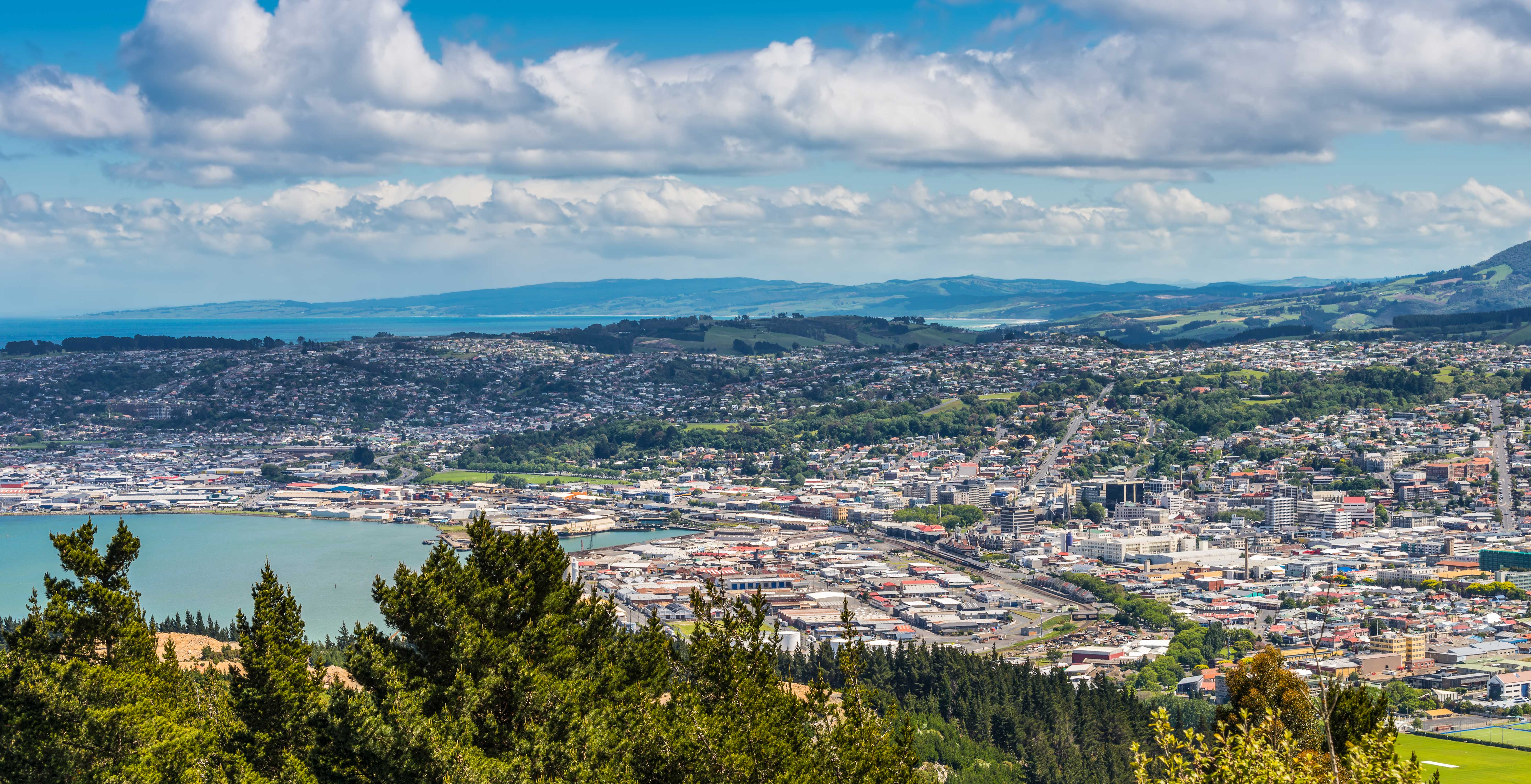
South Dunedin is a vibrant and important part of Dunedin city which is home to more than 13,000 people, 6,000 households, several hundred businesses, and an array of critical infrastructure. South Dunedin is also exposed to a range of natural hazards, many of which are expected to increase in frequency and severity with the effects of climate change.

South Dunedin Future (SDF) is a joint programme built to find ways to respond to climate change and flooding problems in South Dunedin. This project is one of the first of its kind in New Zealand, which is focused on community scale adaptation in an urban city environment.

The purpose of the SDF programme is to enable South Dunedin to prepare for, and adapt to, the impacts of climate change, while also realising the opportunities that come with change.

The programme, led by Dunedin City Council and Otago Regional Council, is supported by the consultant team ‘Kia Rōpine’, which includes Tonkin + Taylor, WSP, Beca, and GT Connect. The project also worked with local experts and community contributors. Mana whenua engagement was facilitated by Aukaha.

Services

  • Comprehensive Climate Risk Assessment
  • Hazard Identification and Mapping
  • Spatial Risk Profiling
  • Integration of Cultural Risk Perspectives
  • Scenario Modelling
  • Stakeholder and Community Engagement
  • Adaptation Planning Support
  • Risk Communication
  • Expert Validation and Peer Review
  • Business Case Input

Clients

  • Dunedin City Council
  • Otago Regional Council

Year

  • 2023-2027

South Dunedin Future: the case for change

Why this matters

South Dunedin sits on reclaimed land close to the city centre and is already exposed to frequent flooding and shallow groundwater. Climate change will increase rainfall intensity, raise sea level and elevate groundwater. Without proportionate adaptation, much of the area will face reduced functionality of buildings, infrastructure and community services with broad social and economic consequences for Dunedin.

Quick facts

  • Population of more than 13,000 people
  • Around 6,000 households
  • Approximately 90 kilometres of roads within the area
  • Key hazards assessed pluvial flooding, coastal inundation, high groundwater, coastal erosion, landslide and liquefaction

What we assessed

We produced a spatial risk assessment that quantifies exposure and vulnerability across twelve elements at risk, including buildings transport networks parks three waters infrastructure energy and telecommunications. The assessment covers present day (2024) mid-century (2060 to 2070) and late century (2100) timeframes under representative climate scenarios. The method combines geospatial hazard modelling expert validation and engagement with asset owners and mana whenua.

Key findings

  • Baseline risk is high. Present day exposure is dominated by pluvial flooding and high groundwater.
  • Risk increases substantially over time. By mid-century, many places and assets will face multiple hazards and declining serviceability.
  • Late century projections show widespread high risk to buildings and infrastructure under high emissions scenarios because of rising sea level and groundwater.
  • Roads sports fields and wastewater infrastructure are particularly sensitive to chronic groundwater impacts.
  • There are cascading social and economic impacts including housing quality reduced insurability and increased cost of living.

Lessons learned

  • A clear purpose and proportionate approach keep the assessment targeted and useful.
  • Early and ongoing engagement with asset owners, community groups and mana whenua improves relevance and confidence in results.
  • Imperfect data should be used transparently to support planning while recognising limitations.
  • Risk communication must be tailored to different audiences and avoid property specific misinterpretation.
  • Expert validation and a mana whenua lens strengthen decision making and cultural assessment.

What happens next

The programme is testing seven possible futures with the community, mana whenua, and other stakeholders. The next steps are to shortlist preferred adaptation pathways evaluate their efficacy using the risk baseline and develop business cases for implementation. The goal is to identify options that reduce risk and preserve wellbeing and function for the widest number of people and assets.

Acknowledgements

This vital work was led by South Dunedin Future project team at Dunedin City Council and Otago Regional Council, with support from the Kia Rōpine consultant team; Tonkin + Taylor, WSP, Beca, and G&T Connect. The project also worked with local experts and community contributors. Mana whenua engagement was facilitated by Aukaha.

Dunedin

Explore More Projects

LEAD Housing Development Programme, Auckland

LEAD Housing Development Programme, Auckland

Drury South Crossing Precinct

Drury South Crossing Precinct

previous arrow
next arrow

How can we help?

Get in touch with a Tonkin + Taylor representative today. Our friendly and knowledgeable team make it easy to find the right solution to suit your specific needs.

Get In Touch